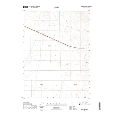
2018 Map of Pequop Summit SW
USGS Topo · Published 2018About this map
Independence Valley dominates the central portion of this Elko County quadrangle, where the desert landscape is defined by the drainage of Independence Cr. To the east, the rising slopes of the Pequop Mountains create a sharp contrast in topography, containing features like Maverick Canyon. This area represents a critical high-desert transit corridor, with the modern infrastructure of Interstate 80 and Alternate U.S. 93 slicing through the valley floor to connect remote northeastern Nevada ranchlands and mining regions. Seasonally dependent waterways like Barnet Springs Cr and W Squaw Cr trace the drainages from the higher elevations, illustrating the sparse but vital water network that has historically dictated land use and transit in this high-altitude basin.
Find a feature on this map
12 named features on this map. Tap any name to fly to it.
Don’t see what you’re looking for? This feature index may not catch every label — zoom into the map to look around manually.
Map Details
Editions of this 2018 Pequop Summit SW Map
This is the sole edition of this map. No revisions or reprints were ever made.
Other maps of this area

1955 · Wells
USGS Topo · 1:250,000

1955 · Elko
USGS Topo · 1:250,000

1958 · Wells
USGS Topo · 1:250,000

1958 · Elko
USGS Topo · 1:250,000

1961 · Wells
USGS Topo · 1:250,000

1962 · Elko
USGS Topo · 1:250,000

1965 · Elko
USGS Topo · 1:250,000

1968 · Moor Summit
USGS Topo · 1:24,000

1968 · Independence Valley NE
USGS Topo · 1:24,000

1968 · Holborn
USGS Topo · 1:24,000