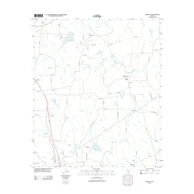
2013 Map of Percilla
USGS Topo · Published 2013About this map
Percilla and the surrounding farm-to-market roads of Houston County reveal a landscape shaped by rural community hubs and natural springs. The terrain is defined by the winding paths of San Pedro Cr and Ioni Cr, with notable landmarks like Houston Mound rising above the creek bottoms. Small settlements such as Salmon and Union Crossing anchor the western portion of the map, while Mound City serves as a northern reference point. Local genealogy is well-documented through numerous burial grounds, including the Gulceville Cem and Dunham Harmon Cem. The presence of Green Springs and Yarborough Springs suggests the historical importance of reliable water sources for early residents in this region of East Texas, where the road network follows established paths like Lost Springs Ranch Rd through the creek-dissected hills.
Find a feature on this map
82 named features on this map. Tap any name to fly to it.
Don’t see what you’re looking for? This feature index may not catch every label — zoom into the map to look around manually.
Map Details
Editions of this 2013 Percilla Map
This is the sole edition of this map. No revisions or reprints were ever made.
Other maps of this area

1950 · Crockett NE
USGS Topo · 1:24,000

1951 · Grapeland
USGS Topo · 1:24,000

1951 · Crockett NE
USGS Topo · 1:24,000

1951 · Elkhart
USGS Topo · 1:62,500

1952 · Slocum
USGS Topo · 1:62,500

1953 · Palestine
USGS Topo · 1:250,000

1957 · Palestine
USGS Topo · 1:250,000

1964 · Hays Spring
USGS Topo · 1:24,000

1981 · Palestine
USGS Topo · 1:100,000
1982 · Percilla
USGS Topo · 1:24,000