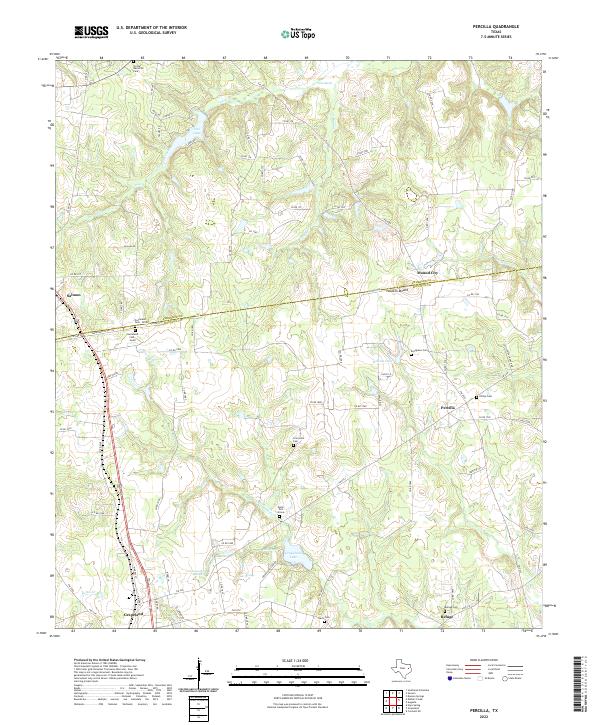
2022 Map of Percilla
USGS Topo · Published 2022About this map
Grapeland sits at the southwestern edge of this survey, marking a significant hub of activity in Houston County. Northward, the land rises toward Houston Mound and the small community of Mound City, revealing a landscape defined by its rural cemetery network and watercourses. Genealogists will find a high concentration of burial sites, including the uniquely named Eleck Turk Grave and the dual grounds of Gulceland Cem - North and Gulceland Cem - South.
Find a feature on this map
89 named features on this map. Tap any name to fly to it.
Don’t see what you’re looking for? This feature index may not catch every label — zoom into the map to look around manually.
Map Details
Editions of this 2022 Percilla Map
This is the sole edition of this map. No revisions or reprints were ever made.
Other maps of this area

1950 · Crockett NE
USGS Topo · 1:24,000

1951 · Grapeland
USGS Topo · 1:24,000

1951 · Crockett NE
USGS Topo · 1:24,000

1951 · Elkhart
USGS Topo · 1:62,500

1952 · Slocum
USGS Topo · 1:62,500

1953 · Palestine
USGS Topo · 1:250,000

1957 · Palestine
USGS Topo · 1:250,000

1964 · Hays Spring
USGS Topo · 1:24,000

1981 · Palestine
USGS Topo · 1:100,000
1982 · Percilla
USGS Topo · 1:24,000