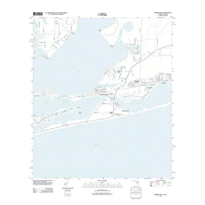
2012 Map of Perdido Bay
USGS Topo · Published 2012About this map
Perdido Bay and the complex barrier island geography of the Alabama-Florida line define this coastal landscape. The map details the intricate waterways of Tarkiln Bay, Big Lagoon, and Old River, which separate the mainland from the narrow ribbon of Perdido Key. Settlement patterns are concentrated on Ono Island and the residential corridors of Gulf Beach Heights and Seaglades. This 2012 survey captures the region's recreational and residential infrastructure, from the Holiday Harbor Marina to the preservation area of Johnsons Beach. The presence of landmarks like Canal Bridge and the various points—Inerarity, Tarkiln, and Du Pont Point—illustrate the jagged, finger-like peninsulas that characterize this bay system. The interface between the freshwater drainage of Soldier Creek and the salt waters of the Gulf of Mexico creates a diverse estuarine environment typical of the Gulf Coast.
Find a feature on this map
105 named features on this map. Tap any name to fly to it.
Don’t see what you’re looking for? This feature index may not catch every label — zoom into the map to look around manually.
Map Details
Editions of this 2012 Perdido Bay Map
This is the sole edition of this map. No revisions or reprints were ever made.
Other maps of this area

1921 · Bon Secour
USGS Topo · 1:62,500

1921 · Fort Barrancas
USGS Topo · 1:62,500

1941 · Fort Barrancas
USGS Topo · 1:62,500

1941 · Foley
USGS Topo · 1:62,500

1943 · Fort Barrancas
USGS Topo · 1:62,500

1943 · Foley
USGS Topo · 1:62,500

1944 · Perdido Bay North
USGS Topo · 1:25,000

1944 · Miflin
USGS Topo · 1:25,000

1944 · West Pensacola
USGS Topo · 1:25,000

1944 · Perdido Bay South
USGS Topo · 1:25,000
Featured Places
- Perdido Beach, AL
- Chanticleer, FL
- Gulf Beach Heights, FL
- Perdido Bay Country Club Estates, FL
- Treasure Hill Park, FL