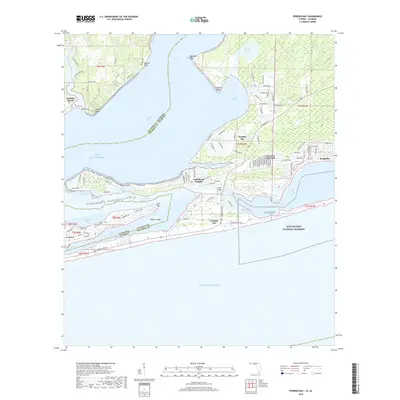
2018 Map of Perdido Bay
USGS Topo · Published 2018About this map
Perdido Beach and the surrounding coastal reaches of Perdido Bay define this landscape along the border of Baldwin County, Alabama, and Escambia County, Florida. This 2018 survey documents the complex geography of the Gulf Coast, where the Intracoastal Waterway and Old River separate residential developments on Ono Island and Perdido Key from the mainland. The area is characterized by low-lying wetlands and protective inlets, including Tarkiln Bayou and Tarkiln Bay, alongside prominent landforms like Red Bluff and Manuel Point. The map provides a detailed view of coastal land use, showing established neighborhoods like Gulf Beach Heights and Seaglades positioned north of the expansive Gulf Islands National Seashore. It serves as a definitive record of the shoreline and maritime infrastructure, including the Canal Bridge, at a time of continued coastal habitation and conservation.
Find a feature on this map
109 named features on this map. Tap any name to fly to it.
Don’t see what you’re looking for? This feature index may not catch every label — zoom into the map to look around manually.
Map Details
Editions of this 2018 Perdido Bay Map
This is the sole edition of this map. No revisions or reprints were ever made.
Other maps of this area

1921 · Bon Secour
USGS Topo · 1:62,500

1921 · Fort Barrancas
USGS Topo · 1:62,500

1941 · Fort Barrancas
USGS Topo · 1:62,500

1941 · Foley
USGS Topo · 1:62,500

1943 · Fort Barrancas
USGS Topo · 1:62,500

1943 · Foley
USGS Topo · 1:62,500

1944 · Perdido Bay North
USGS Topo · 1:25,000

1944 · Miflin
USGS Topo · 1:25,000

1944 · West Pensacola
USGS Topo · 1:25,000

1944 · Perdido Bay South
USGS Topo · 1:25,000
Featured Places
- Perdido Beach, AL
- Chanticleer, FL
- Gulf Beach Heights, FL
- Perdido Bay Country Club Estates, FL
- Treasure Hill Park, FL