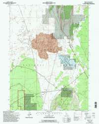
1993 Map of Perez
USGS Topo · Published 1997About this map
Timber Mountain and the surrounding volcanic terrain of the Modoc National Forest dominate this northern California landscape, defined by expansive fields of Lava and subterranean features like Mammoth Cave. The mapping reflects a complex layering of environmental history, specifically noting the Shore of the Lake 1873 (Site) near Dry Lake, which provides a clear reference point for the region's changing hydrology. Infrastructure supporting the remote communities of Perez and Tionesta includes a Pipeline with an associated Compressor Station, while a local Landing Strip and a network of 4wd trails facilitate access through the timbered highlands.
Find a feature on this map
23 named features on this map. Tap any name to fly to it.
Don’t see what you’re looking for? This feature index may not catch every label — zoom into the map to look around manually.
Map Details
Editions of this 1993 Perez Map
2 editions found
Other maps of this area

1886 · Modoc Lava Bed
USGS Topo · 1:250,000

1892 · Modoc Lava-Bed
USGS Topo · 1:250,000

1951 · Clear Lake Reservoir
USGS Topo · 1:62,500

1951 · Tulelake
USGS Topo · 1:62,500

1952 · Timber Mountain
USGS Topo · 1:62,500

1952 · Hackamore
USGS Topo · 1:62,500

1954 · Alturas
USGS Topo · 1:250,000

1958 · Alturas
USGS Topo · 1:250,000

1962 · Alturas
USGS Topo · 1:250,000

1965 · Alturas
USGS Topo · 1:250,000