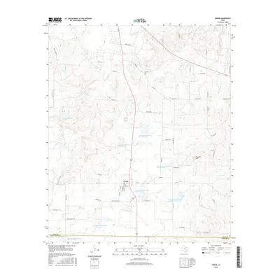
2016 Map of Perrin
USGS Topo · Published 2016About this map
Perrin serves as the central hub of this North Texas landscape, situated at the intersection of local routes and surrounded by an extensive network of water management projects. The map documents a highly managed hydrological system, featuring numerous numbered reservoirs such as Soil Conservation Service Site 4 Reservoir and Soil Conservation Service Site 7 Reservoir. These structures, scattered across the drainage basins of E Fork Keechi Cr and Two Bush Br, illustrate the region's historical reliance on soil and water conservation efforts to support local agriculture. Prominent landmarks like Two Bush Knob and Wampler Hill rise above the stream valleys, while local history is anchored at Perrin Cem and Fairview Cem, marking generations of settlement near the Jack County and Palo Pinto County line.
Find a feature on this map
63 named features on this map. Tap any name to fly to it.
Don’t see what you’re looking for? This feature index may not catch every label — zoom into the map to look around manually.
Map Details
Editions of this 2016 Perrin Map
This is the sole edition of this map. No revisions or reprints were ever made.
Other maps of this area

1891 · Weatherford
USGS Topo · 1:125,000

1891 · Palo Pinto
USGS Topo · 1:125,000

1893 · Weatherford
USGS Topo · 1:125,000

1918 · Palo Pinto
USGS Topo · 1:125,000

1924 · Palo Pinto 1-b
USGS Topo · 1:48,000

1927 · Mineral Wells
USGS Topo · 1:62,500

1954 · Dallas
USGS Topo · 1:250,000

1954 · Sherman
USGS Topo · 1:250,000

1954 · Abilene
USGS Topo · 1:250,000

1954 · Wichita Falls
USGS Topo · 1:250,000