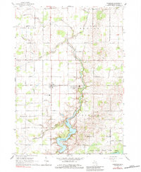
1965 Map of Perrinton
USGS Topo · Published 1984About this map
Rainbow Lake and the winding course of Pine Creek dominate this mid-century look at Gratiot County, where the agricultural landscape is divided by a series of engineered watercourses including Newark Drain and Styx River. The villages of Middleton and Perrinton serve as the primary hubs, linked by the Grand Trunk railroad line that cuts through the central townships.
Find a feature on this map
38 named features on this map. Tap any name to fly to it.
Don’t see what you’re looking for? This feature index may not catch every label — zoom into the map to look around manually.
Map Details
Editions of this 1965 Perrinton Map
2 editions found
Other maps of this area

1918 · Perrinton
USGS Topo · 1:62,500

1935 · Alma
USGS Topo · 1:62,500

1938 · Alma
USGS Topo · 1:62,500

1943 · Perrinton
USGS Topo · 1:62,500

1954 · Midland
USGS Topo · 1:250,000

1958 · Midland
USGS Topo · 1:250,000

1959 · Midland
USGS Topo · 1:250,000

1965 · Sumner
USGS Topo · 1:24,000
1965 · Perrinton
USGS Topo · 1:24,000
1965 · Pompeii
USGS Topo · 1:24,000