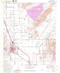
1967 Map of Perris
USGS Topo · Published 1980About this map
Perris serves as the focal point of this late 1960s survey, updated with purple revisions in 1979 to show the rapid expansion of the urban area. The landscape is defined by the significant footprint of the Perris Reservoir to the northeast, held back by the Bernasconi Hills and Potrero terrain. Transportation and infrastructure dominate the valley floor, where the Atchison Topeka and Santa Fe railroad runs parallel to the Escondido Freeway, supporting a region transitioning from agricultural holdings like Mayer Farms to suburban and military utility.
Find a feature on this map
50 named features on this map. Tap any name to fly to it.
Don’t see what you’re looking for? This feature index may not catch every label — zoom into the map to look around manually.
Map Details
Editions of this 1967 Perris Map
4 editions found
Other maps of this area

1901 · Southern California Sheet No. 1
USGS Topo · 1:250,000

1901 · Elsinore
USGS Topo · 1:125,000

1901 · Riverside
USGS Topo · 1:62,500

1904 · Southern California Sheet No. 1
USGS Topo · 1:250,000

1942 · Lake Elsinore
USGS Topo · 1:62,500

1942 · Murrieta
USGS Topo · 1:62,500

1942 · Riverside
USGS Topo · 1:62,500

1942 · Perris
USGS Topo · 1:62,500

1943 · Perris
USGS Topo · 1:62,500

1943 · Riverside
USGS Topo · 1:62,500