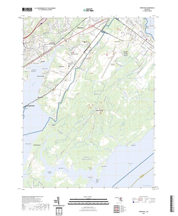
2023 Map of Perryman
USGS Topo · Published 2023About this map
Aberdeen Proving Ground dominates the eastern half of this landscape, reflecting a century of military integration into Harford County. The map details the specialized infrastructure of this installation, including the Phillips Army Airfield and the tactical grid of Trench Warfare Range Rd. Scattered along the edges of the military reservation are older civilian footprints like Michaelsville and Old Baltimore, which stand in contrast to the developed residential clusters of Riverside and Edgewood.
Find a feature on this map
65 named features on this map. Tap any name to fly to it.
Don’t see what you’re looking for? This feature index may not catch every label — zoom into the map to look around manually.
Map Details
Editions of this 2023 Perryman Map
This is the sole edition of this map. No revisions or reprints were ever made.
Other maps of this area

1893 · Gunpowder
USGS Topo · 1:62,500

1898 · Tolchester
USGS Topo · 1:125,000

1900 · Havre De Grace
USGS Topo · 1:62,500

1900 · Betterton
USGS Topo · 1:62,500

1901 · Belair
USGS Topo · 1:62,500

1901 · Gunpowder
USGS Topo · 1:62,500

1903 · Tolchester
USGS Topo · 1:125,000

1908 · Tolchester
USGS Topo · 1:125,000

1941 · Gunpowder
USGS Topo · 1:62,500

1942 · Havre De Grace
USGS Topo · 1:62,500