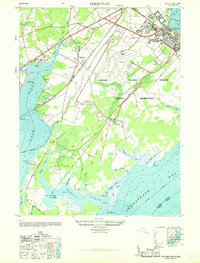
1968 Map of Perryman
USGS Topo · Published 1968About this map
The Aberdeen Proving Ground Military Reservation dominates the landscape of Harford County, showing a complex of military infrastructure along the Chesapeake Bay. Settlement patterns center on Perryman and Stepney, where the Pennsylvania and Baltimore and Ohio railroads intersect the coastal plain. Local heritage is visible in the placement of the Spesutie Church (Cem), Perryman School, and the inland Harford Furnace School. Along the shoreline, the map identifies small points and coves like Chilbury Point and Romney Creek, alongside the coastal settlement of Old Baltimore. The transition from agrarian life to military facility is evidenced by labeled sites such as Ford's Farm and Phillips Field situated near the proving grounds.
Find a feature on this map
67 named features on this map. Tap any name to fly to it.
Don’t see what you’re looking for? This feature index may not catch every label — zoom into the map to look around manually.
Map Details
Editions of this 1968 Perryman Map
This is the sole edition of this map. No revisions or reprints were ever made.
Other maps of this area

1893 · Gunpowder
USGS Topo · 1:62,500

1898 · Tolchester
USGS Topo · 1:125,000

1900 · Havre De Grace
USGS Topo · 1:62,500

1900 · Betterton
USGS Topo · 1:62,500

1901 · Belair
USGS Topo · 1:62,500

1901 · Gunpowder
USGS Topo · 1:62,500

1903 · Tolchester
USGS Topo · 1:125,000

1908 · Tolchester
USGS Topo · 1:125,000

1941 · Gunpowder
USGS Topo · 1:62,500

1942 · Havre De Grace
USGS Topo · 1:62,500