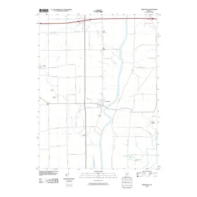
2010 Map of Perrysville
USGS Topo · Published 2010About this map
Perrysville sits prominently on the western bank of the Wabash River, appearing in this 2010 survey as a focal point for the surrounding agricultural landscape. The town is flanked by smaller settlements like Gessie to the northwest and Flat Iron to the west, linked by a network of rural county roads. This area of Vermillion County is deeply etched with watercourses, including Jordan Creek, Jericho Creek, and Spring Creek, which feed into the larger river system. Local genealogy and land use are well represented by several burial grounds, such as Chenoweth Cemetery and Lower Mound Cemetery. Economic and recreational features are evident in the south, where Coffing Brothers Lake and the associated Coffing Brothers Dam appear alongside Coal Creek. Transportation infrastructure is further noted by the presence of Highland Airport, located just north of the Flat Iron community.
Find a feature on this map
55 named features on this map. Tap any name to fly to it.
Don’t see what you’re looking for? This feature index may not catch every label — zoom into the map to look around manually.
Map Details
Editions of this 2010 Perrysville Map
This is the sole edition of this map. No revisions or reprints were ever made.
Other maps of this area

1899 · Danville
USGS Topo · 1:62,500

1900 · Danville
USGS Topo · 1:62,500

1947 · Ridge Farm
USGS Topo · 1:62,500

1950 · Danville SE
USGS Topo · 1:24,000

1950 · Danville NE
USGS Topo · 1:24,000

1951 · Danville NE
USGS Topo · 1:24,000

1951 · Danville SE
USGS Topo · 1:24,000

1953 · Danville
USGS Topo · 1:250,000

1953 · Indianapolis
USGS Topo · 1:250,000

1955 · Danville
USGS Topo · 1:250,000