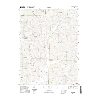
2016 Map of Perryton
USGS Topo · Published 2016About this map
Wakatomika Creek and its many tributaries, including Nickel Valley Run and Brushy Fork, carve through this section of eastern Ohio where four counties converge. The landscape is defined by small, dispersed settlements like Fallsburg and Perryton, connected by a network of township roads and county highways. For genealogists and local historians, the area is rich with family-named landmarks and resting places such as Fallsburg Cem, Meek Cem, and Mount Pleasant Cem. The agricultural and transit history of the region is evident in the survival of notable infrastructure, including the Gregg Mill Bridge and Moran Bridge, which facilitate travel over the winding waterways. The map also records smaller junctions and hamlets like Frampton and Tilton Crossroads, alongside terrain features such as Ashcraft Ridge and Fox Den Knob.
Find a feature on this map
110 named features on this map. Tap any name to fly to it.
Don’t see what you’re looking for? This feature index may not catch every label — zoom into the map to look around manually.
Map Details
Editions of this 2016 Perryton Map
This is the sole edition of this map. No revisions or reprints were ever made.
Other maps of this area

1909 · Newark
USGS Topo · 1:62,500

1910 · Frazeysburg
USGS Topo · 1:62,500

1912 · Gambier
USGS Topo · 1:62,500

1913 · Brinkhaven
USGS Topo · 1:62,500

1914 · Gambier
USGS Topo · 1:62,500

1915 · Brinkhaven
USGS Topo · 1:62,500

1943 · Gambier
USGS Topo · 1:62,500

1950 · Marion
USGS Topo · 1:250,000

1961 · Hanover
USGS Topo · 1:24,000
1961 · Walhonding
USGS Topo · 1:24,000