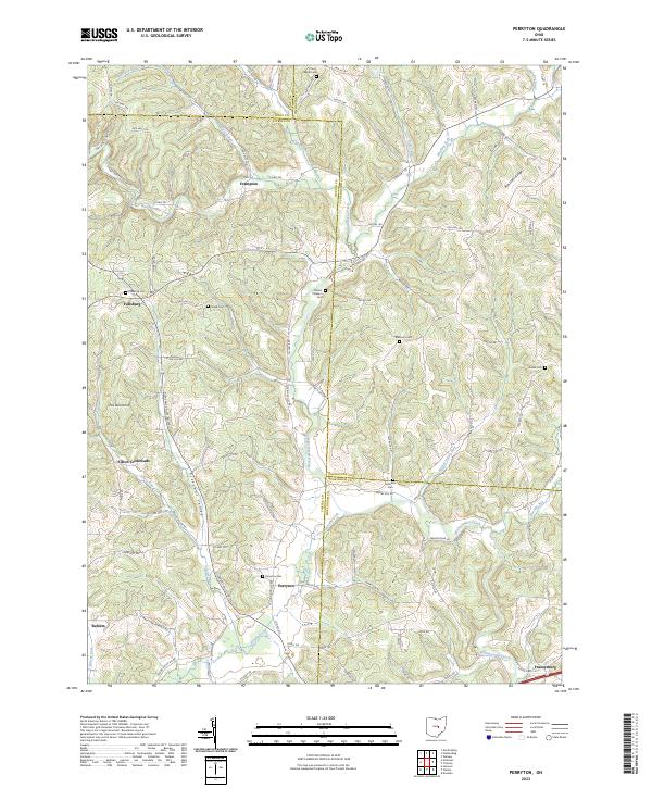
2023 Map of Perryton
USGS Topo · Published 2023About this map
Wakatomika Creek and its many tributaries, including Brushy Fork, Winding Fork, and Nickel Valley Run, define the rolling geography of this Licking County region. The landscape is dotted with small, historic rural settlements like Fallsburg, Perryton, and Frazeysburg, which serve as anchors for the surrounding agricultural and wooded terrain. Genealogists will find a high density of burial grounds throughout the area, including Fallsburg Cem, Meek Cem, and Perryton Cem, many situated on high ground or near creek bends. The map highlights the complex county boundaries where Licking, Knox, Coshocton, and Muskingum counties meet, a configuration that has historically influenced local land ownership and municipal services. Landmarks like Fox Den Knob and Ashcraft Ridge provide prominent relief points over the networks of township roads and county highways that lace the valleys.
Find a feature on this map
102 named features on this map. Tap any name to fly to it.
Don’t see what you’re looking for? This feature index may not catch every label — zoom into the map to look around manually.
Map Details
Editions of this 2023 Perryton Map
This is the sole edition of this map. No revisions or reprints were ever made.
Other maps of this area

1909 · Newark
USGS Topo · 1:62,500

1910 · Frazeysburg
USGS Topo · 1:62,500

1912 · Gambier
USGS Topo · 1:62,500

1913 · Brinkhaven
USGS Topo · 1:62,500

1914 · Gambier
USGS Topo · 1:62,500

1915 · Brinkhaven
USGS Topo · 1:62,500

1943 · Gambier
USGS Topo · 1:62,500

1950 · Marion
USGS Topo · 1:250,000

1961 · Hanover
USGS Topo · 1:24,000
1961 · Walhonding
USGS Topo · 1:24,000