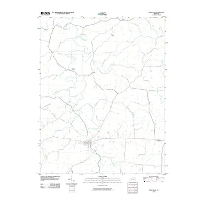
2010 Map of Perryville
USGS Topo · Published 2010About this map
The Chaplin River snakes through this central Kentucky landscape, defining the topography of a region steeped in nineteenth-century history. At the southern edge of the map, Perryville serves as a focal point where numerous roads and waterways converge. The town's historical footprint is traceable through its surrounding infrastructure, including the Doctors Fork and Bull Run tributaries. Rural life is anchored by small settlements like Dixville and Rose Hill, and documented by local markers such as the Saint Nicholas Cemetery and Patterson Cemetery. To the east, the Salt River and Quirks Run mark the boundary near the community of Needmore. The dense network of family-named routes, such as Cocanougher Rd and Hays Mays Rd, reflects generations of land ownership and agricultural development across the Boyle County countryside.
Find a feature on this map
47 named features on this map. Tap any name to fly to it.
Don’t see what you’re looking for? This feature index may not catch every label — zoom into the map to look around manually.
Map Details
Editions of this 2010 Perryville Map
This is the sole edition of this map. No revisions or reprints were ever made.
Other maps of this area

1905 · Harrodsburg
USGS Topo · 1:125,000

1952 · Perryville
USGS Topo · 1:24,000

1952 · Danville
USGS Topo · 1:24,000

1952 · Harrodsburg
USGS Topo · 1:24,000

1952 · Cornishville
USGS Topo · 1:24,000

1952 · Junction City
USGS Topo · 1:24,000

1952 · Parksville
USGS Topo · 1:24,000

1953 · Mackville
USGS Topo · 1:24,000

1953 · Gravel Switch
USGS Topo · 1:24,000

1953 · Cardwell
USGS Topo · 1:24,000