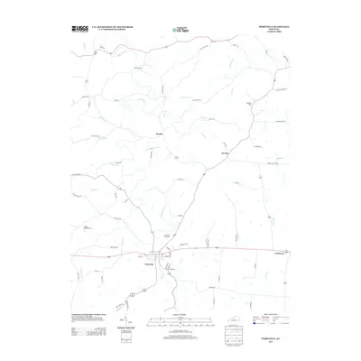
2013 Map of Perryville
USGS Topo · Published 2013About this map
The Chaplin River and its numerous tributaries, including Dry Fork and Phil Williams Run, define the rolling drainage patterns of this central Kentucky landscape. Perryville serves as the primary hub, where several regional routes converge near the Perryville Fairground. The surrounding countryside is dotted with small communities and named landmarks like Dixville, Nevada, and Needmore, reflecting a long-established rural settlement pattern that follows the winding watercourses and ridgelines. To the west, the Battle Field Airport stands near Wilson Cr, while the northern portion of the map is punctuated by Laurel Hill and Rose Hill. This 2013 survey illustrates how modern infrastructure, such as Claunch Rd and Bond Rd, has been overlaid upon a traditional agrarian network of creeks like Doctors Fork and Bull Run.
Find a feature on this map
76 named features on this map. Tap any name to fly to it.
Don’t see what you’re looking for? This feature index may not catch every label — zoom into the map to look around manually.
Map Details
Editions of this 2013 Perryville Map
This is the sole edition of this map. No revisions or reprints were ever made.
Other maps of this area

1905 · Harrodsburg
USGS Topo · 1:125,000

1952 · Perryville
USGS Topo · 1:24,000

1952 · Danville
USGS Topo · 1:24,000

1952 · Harrodsburg
USGS Topo · 1:24,000

1952 · Cornishville
USGS Topo · 1:24,000

1952 · Junction City
USGS Topo · 1:24,000

1952 · Parksville
USGS Topo · 1:24,000

1953 · Mackville
USGS Topo · 1:24,000

1953 · Gravel Switch
USGS Topo · 1:24,000

1953 · Cardwell
USGS Topo · 1:24,000