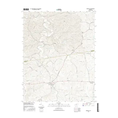
2016 Map of Perryville
USGS Topo · Published 2016About this map
Perryville National Cem stands as a central historical landmark within this survey, located just west of the Chaplin River and the town's street grid. The settlement pattern radiates from the intersection of Harrodsburg RD and Perryville RD, where the local cemetery at Hillcrest Cem serves the community. The surrounding countryside is defined by the branching waters of Doctors Fork and Wilson Cr, as well as numerous smaller family burial sites like the Patterson Family Cem.
Find a feature on this map
70 named features on this map. Tap any name to fly to it.
Don’t see what you’re looking for? This feature index may not catch every label — zoom into the map to look around manually.
Map Details
Editions of this 2016 Perryville Map
This is the sole edition of this map. No revisions or reprints were ever made.
Other maps of this area

1905 · Harrodsburg
USGS Topo · 1:125,000

1952 · Perryville
USGS Topo · 1:24,000

1952 · Danville
USGS Topo · 1:24,000

1952 · Harrodsburg
USGS Topo · 1:24,000

1952 · Cornishville
USGS Topo · 1:24,000

1952 · Junction City
USGS Topo · 1:24,000

1952 · Parksville
USGS Topo · 1:24,000

1953 · Mackville
USGS Topo · 1:24,000

1953 · Gravel Switch
USGS Topo · 1:24,000

1953 · Cardwell
USGS Topo · 1:24,000