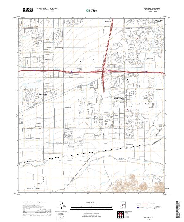
2021 Map of Perryville
USGS Topo · Published 2021About this map
Goodyear and Buckeye anchoring this Western Maricopa County landscape illustrate the rapid suburban transformation of the Salt River Valley. The map captures a complex network of water management systems critical to this arid region, including the Buckeye Canal and the S Extension Canal flowing south toward the Gila River. This irrigation infrastructure permitted the development of agricultural outposts like Liberty and Perryville amidst a terrain defined by desert washes such as Tractor Wash and Jackrabbit Trail Wash. Aviation and industrial history are represented by the sprawling Phoenix Goodyear Airport in the east, while smaller communities like Litchfield Park and McMicken show the footprint of earlier 20th-century settlement patterns. Modern landmarks, such as the Christ Presbyterian Columbarium, sit alongside established desert features like Estrella Camp.
Find a feature on this map
205 named features on this map. Tap any name to fly to it.
Don’t see what you’re looking for? This feature index may not catch every label — zoom into the map to look around manually.
Map Details
Editions of this 2021 Perryville Map
This is the sole edition of this map. No revisions or reprints were ever made.
Other maps of this area

1946 · Avondale
USGS Topo · 1:62,500

1948 · Cashion
USGS Topo · 1:62,500

1954 · Phoenix
USGS Topo · 1:250,000

1957 · Phoenix
USGS Topo · 1:250,000

1957 · White Tank Mts. SE
USGS Topo · 1:24,000

1957 · Valencia
USGS Topo · 1:24,000

1957 · Perryville
USGS Topo · 1:24,000

1957 · El Mirage
USGS Topo · 1:24,000

1957 · Waddell
USGS Topo · 1:24,000

1957 · Tolleson
USGS Topo · 1:24,000