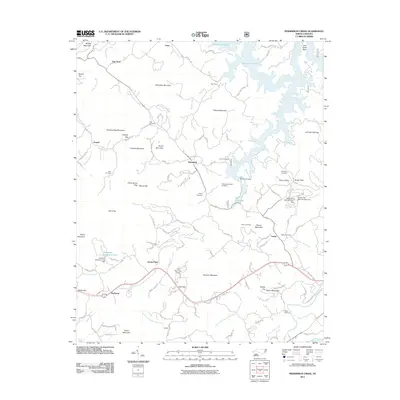
2011 Map of Persimmon Creek
USGS Topo · Published 2011About this map
Persimmon Creek and its many branches form the heart of this Cherokee County landscape, where the waters are controlled by structures like Persimmon Dam and Hideaway Mountain Lake Dam. Small communities and family settlements are dispersed throughout the terrain, connected by rural routes such as Valley Rd and Sandy Gap Rd. The map reveals a high concentration of burial sites, including the Suit Cemetery, Allen Cemetery, and Walker Cemetery, providing significant evidence of established family lineages in the area.
Find a feature on this map
126 named features on this map. Tap any name to fly to it.
Don’t see what you’re looking for? This feature index may not catch every label — zoom into the map to look around manually.
Map Details
Editions of this 2011 Persimmon Creek Map
This is the sole edition of this map. No revisions or reprints were ever made.
Other maps of this area

1888 · Ellijay
USGS Topo · 1:125,000

1892 · Ellijay
USGS Topo · 1:125,000

1893 · Murphy
USGS Topo · 1:125,000

1898 · Ellijay
USGS Topo · 1:125,000

1911 · Ellijay
USGS Topo · 1:125,000

1914 · Murphy
USGS Topo · 1:125,000

1934 · Murphy
USGS Topo · 1:24,000

1934 · Persimmon Creek
USGS Topo · 1:24,000

1934 · McDaniel Bald
USGS Topo · 1:24,000

1934 · Unaka
USGS Topo · 1:24,000