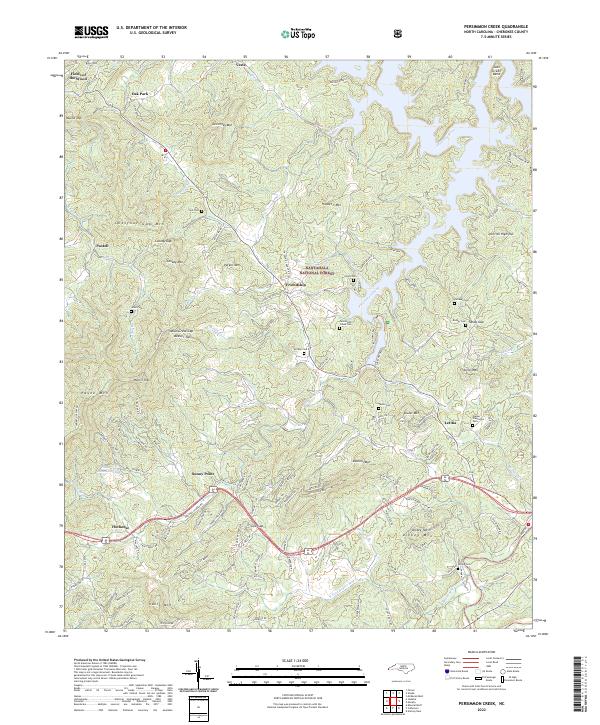
2022 Map of Persimmon Creek
USGS Topo · Published 2022About this map
Nantahala National Forest dominates this landscape in Cherokee County, where the Hiwassee River and Nottely River carve through high ridgelines. The map reveals a dense network of family history markers, including the Walker Plantation Cem, Kirkland Cem, and Clonts Cem, suggesting generations of settlement in the valleys. Notable landmarks like the religious park Fields of the Wood near Oak Park sit alongside geographic features such as The Cut and John Green Bend. The terrain is defined by significant elevations like Ghormley Mtn and Chestnut Gap Mtn, while small communities like Friendship, Postell, and Letitia are connected by roads such as Friendship Church Rd and Culberson Rd. The hydrography is equally complex, featuring Persimmon Creek and Rapier Mill Cr, which historically supported local industry as evidenced by the naming of Walker Mill Cr.
Find a feature on this map
139 named features on this map. Tap any name to fly to it.
Don’t see what you’re looking for? This feature index may not catch every label — zoom into the map to look around manually.
Map Details
Editions of this 2022 Persimmon Creek Map
This is the sole edition of this map. No revisions or reprints were ever made.
Other maps of this area

1888 · Ellijay
USGS Topo · 1:125,000

1892 · Ellijay
USGS Topo · 1:125,000

1893 · Murphy
USGS Topo · 1:125,000

1898 · Ellijay
USGS Topo · 1:125,000

1911 · Ellijay
USGS Topo · 1:125,000

1914 · Murphy
USGS Topo · 1:125,000

1934 · Murphy
USGS Topo · 1:24,000

1934 · Persimmon Creek
USGS Topo · 1:24,000

1934 · McDaniel Bald
USGS Topo · 1:24,000

1934 · Unaka
USGS Topo · 1:24,000