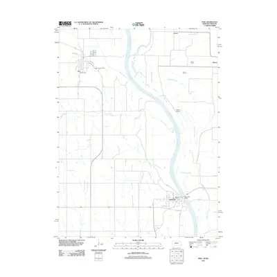
2011 Map of Peru
USGS Topo · Published 2011About this map
Peru and Brownville anchor this riverfront landscape along the Nebraska-Missouri border, where the Missouri River winds through a complex system of sloughs and islands. The terrain is defined by its riparian history, with features like State Line Slough, Whalen Slough, and Evans Island marking the shift between the river's main channel and the lowlands of Nemaha County. In the north, the town of Peru is laid out on a grid including California St and Oregon St, while to the south, the Brownville Bridge provides a vital link across the water. Local heritage is preserved at Mount Vernon Cemetery and Sonora Cemetery, offering clear points of interest for genealogical research. The presence of Garst Airport near the northeastern edge and the confluence of the Nishnabotna River further reflect the region's role as a transportation and drainage hub for the surrounding agricultural plains.
Find a feature on this map
34 named features on this map. Tap any name to fly to it.
Don’t see what you’re looking for? This feature index may not catch every label — zoom into the map to look around manually.
Map Details
Editions of this 2011 Peru Map
This is the sole edition of this map. No revisions or reprints were ever made.
Other maps of this area

1907 · Nebraska City
USGS Topo · 1:62,500

1915 · Nemaha
USGS Topo · 1:62,500

1915 · Howe
USGS Topo · 1:62,500

1939 · Hamburg
USGS Topo · 1:62,500

1939 · Nemaha
USGS Topo · 1:62,500

1941 · Hamburg
USGS Topo · 1:62,500

1949 · Nemaha
USGS Topo · 1:62,500

1955 · Nebraska City
USGS Topo · 1:250,000

1957 · Nebraska City
USGS Topo · 1:250,000

1958 · Nebraska City
USGS Topo · 1:250,000