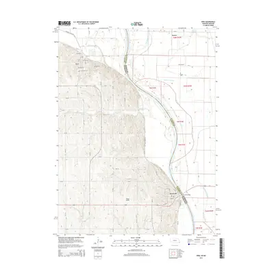
2014 Map of Peru
USGS Topo · Published 2014About this map
Peru and Brownville occupy the western bluffs of the Missouri River in this survey of the Nebraska-Missouri border. The landscape is defined by the sharp contrast between the dissected uplands of Nemaha County and the broad, flat alluvial plain of the river valley to the east. In the north, the campus of Peru State Coll sits overlooking the river, while the Steamboat Trace Trl follows the former rail grade along the base of the bluffs. The river itself serves as a dynamic boundary, with features like State Line Slough and Whalen Slough marking old channels and cutoff meanders near the confluence with the Nishnabotna River. Local history is anchored by sites such as Mt Vernon Cem and Sonora Cem, while the Brownville Bridge provides a critical crossing into Atchison County, Missouri. Small valley landmarks like Happy Hollow and Garst Airport dot the terrain between the bluffs and the winding riverbanks.
Find a feature on this map
46 named features on this map. Tap any name to fly to it.
Don’t see what you’re looking for? This feature index may not catch every label — zoom into the map to look around manually.
Map Details
Editions of this 2014 Peru Map
This is the sole edition of this map. No revisions or reprints were ever made.
Other maps of this area

1907 · Nebraska City
USGS Topo · 1:62,500

1915 · Nemaha
USGS Topo · 1:62,500

1915 · Howe
USGS Topo · 1:62,500

1939 · Hamburg
USGS Topo · 1:62,500

1939 · Nemaha
USGS Topo · 1:62,500

1941 · Hamburg
USGS Topo · 1:62,500

1949 · Nemaha
USGS Topo · 1:62,500

1955 · Nebraska City
USGS Topo · 1:250,000

1957 · Nebraska City
USGS Topo · 1:250,000

1958 · Nebraska City
USGS Topo · 1:250,000