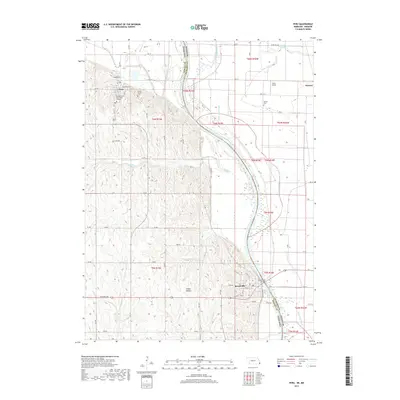
2017 Map of Peru
USGS Topo · Published 2017About this map
The Missouri River carves a winding path through this 2017 survey, defining the state boundary between Peru, Nebraska, and the bottomlands of Missouri. On the Nebraska side, the town of Peru is dominated by the campus of Peru State College, situated on the bluffs overlooking the river valley. To the south, the village of Brownville serves as a critical crossing point via the Brownville Bridge, connecting the rural landscape of Nemaha County with Atchison County.
Find a feature on this map
44 named features on this map. Tap any name to fly to it.
Don’t see what you’re looking for? This feature index may not catch every label — zoom into the map to look around manually.
Map Details
Editions of this 2017 Peru Map
This is the sole edition of this map. No revisions or reprints were ever made.
Other maps of this area

1907 · Nebraska City
USGS Topo · 1:62,500

1915 · Nemaha
USGS Topo · 1:62,500

1915 · Howe
USGS Topo · 1:62,500

1939 · Hamburg
USGS Topo · 1:62,500

1939 · Nemaha
USGS Topo · 1:62,500

1941 · Hamburg
USGS Topo · 1:62,500

1949 · Nemaha
USGS Topo · 1:62,500

1955 · Nebraska City
USGS Topo · 1:250,000

1957 · Nebraska City
USGS Topo · 1:250,000

1958 · Nebraska City
USGS Topo · 1:250,000