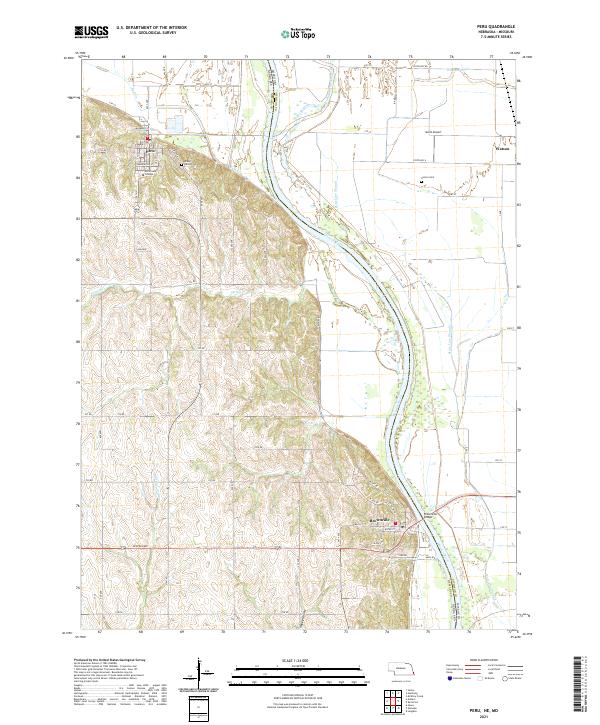
2021 Map of Peru
USGS Topo · Published 2021About this map
Peru and Brownville occupy the western bluffs overlooking the Missouri River valley, where the border between Nebraska and Missouri follows a complex network of waterways. The campus of Peru State College dominates the northern townsite near the Mount Vernon Cem, while Brownville serves as a critical river crossing via the Brownville Bridge. The valley floor is defined by a shifting landscape of sloughs and cutoffs, including Whalen Slough and State Line Slough, which trace the historical path of the Missouri River. To the east, the Nishnabotna River winds through the floodplain near Watson, a small settlement in Missouri. This landscape illustrates the persistent challenge of defining state boundaries along an active river system, where former channels remain as prominent features like Honey Cr and Swartz Run long after the main current has moved.
Find a feature on this map
33 named features on this map. Tap any name to fly to it.
Don’t see what you’re looking for? This feature index may not catch every label — zoom into the map to look around manually.
Map Details
Editions of this 2021 Peru Map
This is the sole edition of this map. No revisions or reprints were ever made.
Other maps of this area

1907 · Nebraska City
USGS Topo · 1:62,500

1915 · Nemaha
USGS Topo · 1:62,500

1915 · Howe
USGS Topo · 1:62,500

1939 · Hamburg
USGS Topo · 1:62,500

1939 · Nemaha
USGS Topo · 1:62,500

1941 · Hamburg
USGS Topo · 1:62,500

1949 · Nemaha
USGS Topo · 1:62,500

1955 · Nebraska City
USGS Topo · 1:250,000

1957 · Nebraska City
USGS Topo · 1:250,000

1958 · Nebraska City
USGS Topo · 1:250,000