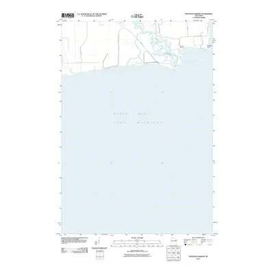
2010 Map of Peshtigo Harbor
USGS Topo · Published 2010About this map
The Peshtigo River delta dominates this coastal landscape where the river meets the waters of Green Bay and Lake Michigan. This 2010 survey illustrates the complex marshland and tributary network near the mouth of the river, specifically highlighting the Peshtigo Point headland. The map reveals a transition from managed conservation land, indicated by the Wisconsin DNR Rd, to the more residential and infrastructure-heavy areas around Slough Bridge and County Hwy-BB. A notable artificial waterway, simply labeled Canal, cuts through the southern shoreline, while roads like Harbor Rd and Shore Rd follow the natural contours of the coast and riverbank. This map captures the intersection of Wisconsin's natural wetlands and the local road networks that serve this lakeside portion of Marinette County.
Find a feature on this map
13 named features on this map. Tap any name to fly to it.
Don’t see what you’re looking for? This feature index may not catch every label — zoom into the map to look around manually.
Map Details
Editions of this 2010 Peshtigo Harbor Map
This is the sole edition of this map. No revisions or reprints were ever made.
Other maps of this area

1939 · Marinette
USGS Topo · 1:48,000

1939 · Porterfield
USGS Topo · 1:48,000

1942 · Porterfield
USGS Topo · 1:48,000

1954 · Escanaba
USGS Topo · 1:250,000

1954 · Manitowoc
USGS Topo · 1:250,000

1956 · Oconto
USGS Topo · 1:62,500

1957 · Escanaba
USGS Topo · 1:250,000

1958 · Escanaba
USGS Topo · 1:250,000

1958 · Manitowoc
USGS Topo · 1:250,000

1961 · Little Sturgeon
USGS Topo · 1:62,500