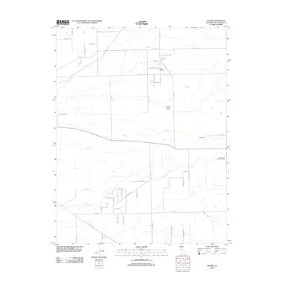
2012 Map of Peters
USGS Topo · Published 2012About this map
Peters serves as the central hub of this agricultural landscape in San Joaquin County, where a grid of rural roads connects family farms and dairy operations. The terrain is defined by the drainage patterns of Mormon Slough in the northwest and Littlejohns Cr to the south, reflecting the complex water management essential to Central Valley farming. Local aviation is represented by the J-B Airport, while the Weststeyn Dairy Number 2 highlights the area's ongoing dairy industry. The map captures a quiet rural character preserved through the early 21st century, with long-established thoroughfares like E Copperopolis Rd and Peters Rd providing the primary structure for the community. In the southeast, the Highland View Memorial Gardens offers a significant point of interest for local genealogy and history, situated amidst the winding path of Duck Cr.
Find a feature on this map
55 named features on this map. Tap any name to fly to it.
Don’t see what you’re looking for? This feature index may not catch every label — zoom into the map to look around manually.
Map Details
Editions of this 2012 Peters Map
This is the sole edition of this map. No revisions or reprints were ever made.
Other maps of this area

1889 · Jackson
USGS Topo · 1:125,000

1892 · Jackson
USGS Topo · 1:125,000

1894 · Lodi
USGS Topo · 1:125,000

1897 · Jackson
USGS Topo · 1:125,000

1902 · Jackson
USGS Topo · 1:125,000

1908 · Waterloo
USGS Topo · 1:31,680

1908 · Linden
USGS Topo · 1:31,680

1914 · Burnham
USGS Topo · 1:31,680

1914 · Manteca
USGS Topo · 1:31,680

1914 · Avena
USGS Topo · 1:31,680