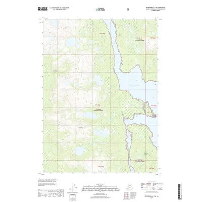
2017 Map of Petersburg A-1 SW
USGS Topo · Published 2017About this map
Mt Etolin anchors the high terrain of central Etolin Island, a significant landmass within the Alexander Archipelago of Southeast Alaska. This 2017 survey details the complex maritime interface of the Tongass National Forest, where steep ridgelines like Mt Shakes drop sharply into the coastal waters of the Gulf of Alaska. The map illustrates the intricate waterways essential for local navigation and ecology, including Menefee Inlet and the narrow Canoe Passage separating the main island from Brownson Island. Small drainage systems like Trout Cr and named coastal landmarks such as Menefee Point and Fisherman Chuck provide precise reference points for maritime history and environmental study within this protected wilderness area.
Find a feature on this map
18 named features on this map. Tap any name to fly to it.
Don’t see what you’re looking for? This feature index may not catch every label — zoom into the map to look around manually.
Map Details
Editions of this 2017 Petersburg A-1 SW Map
This is the sole edition of this map. No revisions or reprints were ever made.
Other maps of this area

1948 · Petersburg A-1
USGS Topo · 1:63,360

1948 · Petersburg A-2
USGS Topo · 1:63,360

1949 · Craig D-2
USGS Topo · 1:63,360

1949 · Craig D-1
USGS Topo · 1:63,360

1951 · Craig D-2
USGS Topo · 1:63,360

1951 · Craig D-1
USGS Topo · 1:63,360

1951 · Petersburg A-1
USGS Topo · 1:63,360

1952 · Petersburg
USGS Topo · 1:250,000

1953 · Petersburg A-2
USGS Topo · 1:63,360

1957 · Craig
USGS Topo · 1:250,000