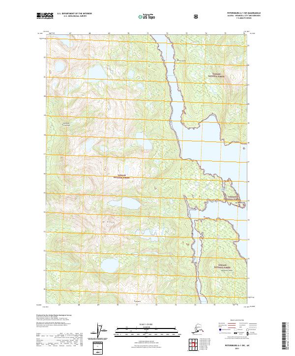
2021 Map of Petersburg A-1 SW
USGS Topo · Published 2021About this map
Etolin Island, a significant landmass within the Alexander Archipelago of Southeast Alaska, is defined by its dramatic relief and intricate coastline. The island's interior is dominated by high peaks, most notably Mt Etolin and Mt Shakes, which overlook the dense timber of the Tongass National Forest. This 2021 survey reveals a landscape shaped by water and elevation, where Trout Cr drains the high country toward the coast. The eastern edge of the island is carved by Menefee Inlet, a deep waterway terminating near Menefee Point. To the southeast, the narrow Canoe Passage separates the main island from Brownson Island, illustrating the complex maritime geography of the region. This map provides a clear view of the wilderness character and natural boundaries of the Alaskan panhandle's inner passage.
Find a feature on this map
16 named features on this map. Tap any name to fly to it.
Don’t see what you’re looking for? This feature index may not catch every label — zoom into the map to look around manually.
Map Details
Editions of this 2021 Petersburg A-1 SW Map
This is the sole edition of this map. No revisions or reprints were ever made.
Other maps of this area

1948 · Petersburg A-1
USGS Topo · 1:63,360

1948 · Petersburg A-2
USGS Topo · 1:63,360

1949 · Craig D-2
USGS Topo · 1:63,360

1949 · Craig D-1
USGS Topo · 1:63,360

1951 · Craig D-2
USGS Topo · 1:63,360

1951 · Craig D-1
USGS Topo · 1:63,360

1951 · Petersburg A-1
USGS Topo · 1:63,360

1952 · Petersburg
USGS Topo · 1:250,000

1953 · Petersburg A-2
USGS Topo · 1:63,360

1957 · Craig
USGS Topo · 1:250,000