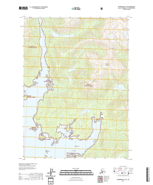
2021 Map of Petersburg A-2 SE
USGS Topo · Published 2021About this map
Tongass National Forest encompasses the entirety of this coastal wilderness on Etolin Island, where the complex shoreline of the Alexander Archipelago creates a network of deep-water inlets and isolated islands. The map showcases the dramatic transition from sea level at Burnett Inlet and McHenry Inlet to the high elevations of Navy Peak. The landscape is defined by its maritime geography, featuring numerous protected waterways such as Jadski Cove and a series of freshwater bodies like Burnett Lake and Hatchery Lake.
Find a feature on this map
29 named features on this map. Tap any name to fly to it.
Don’t see what you’re looking for? This feature index may not catch every label — zoom into the map to look around manually.
Map Details
Editions of this 2021 Petersburg A-2 SE Map
This is the sole edition of this map. No revisions or reprints were ever made.
Other maps of this area

1948 · Petersburg A-1
USGS Topo · 1:63,360

1948 · Petersburg A-2
USGS Topo · 1:63,360

1949 · Craig D-2
USGS Topo · 1:63,360

1949 · Craig D-1
USGS Topo · 1:63,360

1951 · Craig D-2
USGS Topo · 1:63,360

1951 · Craig D-1
USGS Topo · 1:63,360

1951 · Petersburg A-1
USGS Topo · 1:63,360

1952 · Petersburg
USGS Topo · 1:250,000

1953 · Petersburg A-2
USGS Topo · 1:63,360

1957 · Craig
USGS Topo · 1:250,000