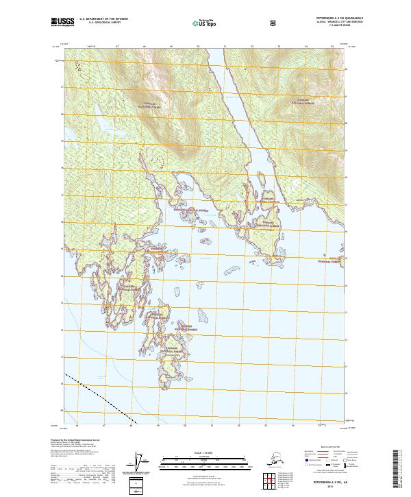
2021 Map of Petersburg A-2 SW
USGS Topo · Published 2021About this map
Tongass National Forest blankets this coastal landscape in the Alexander Archipelago, defined by a labyrinth of inlets and islands south of Petersburg. The maritime geography is anchored by Stanhope Island and its southern extension at Point Stanhope, where the land meets the open waters of Clarence Strait. Further inland, the narrow Mosman Inlet carves deep into the terrain, separating steep forested ridges and leading toward smaller interior water bodies like Streets Lake.
Find a feature on this map
18 named features on this map. Tap any name to fly to it.
Don’t see what you’re looking for? This feature index may not catch every label — zoom into the map to look around manually.
Map Details
Editions of this 2021 Petersburg A-2 SW Map
This is the sole edition of this map. No revisions or reprints were ever made.
Other maps of this area

1948 · Petersburg A-2
USGS Topo · 1:63,360

1949 · Craig D-3
USGS Topo · 1:63,360

1949 · Craig D-2
USGS Topo · 1:63,360

1949 · Petersburg A-3
USGS Topo · 1:63,360

1950 · Craig D-3
USGS Topo · 1:63,360

1951 · Craig D-2
USGS Topo · 1:63,360

1952 · Petersburg
USGS Topo · 1:250,000

1953 · Petersburg A-3
USGS Topo · 1:63,360

1953 · Petersburg A-2
USGS Topo · 1:63,360

1957 · Craig
USGS Topo · 1:250,000