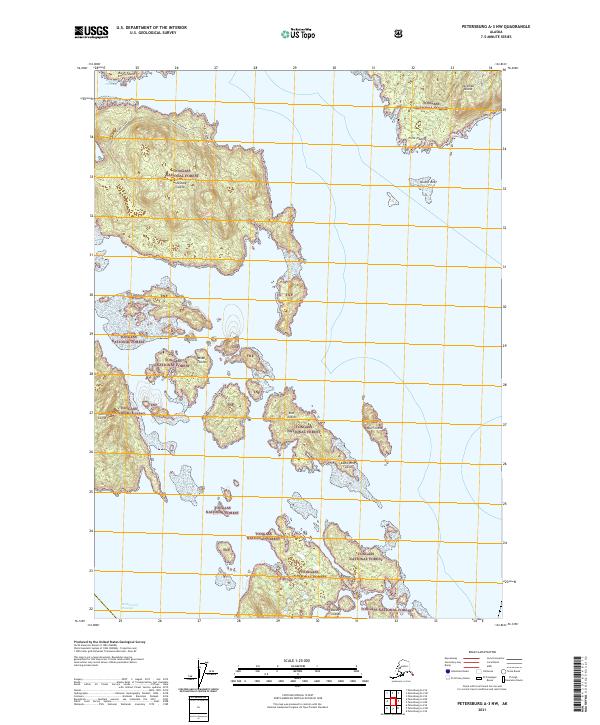
2021 Map of Petersburg A-3 NW
USGS Topo · Published 2021About this map
Tongass National Forest land dominates this maritime survey, illustrating the complex archipelago southeast of Zarembo Island. The map focuses on the navigationally significant Kashevarof Passage and the numerous small landmasses that dot the waterway. In the north, Shrubby Island sits as a central feature, surrounded by hazards such as Point Nesbitt and the submerged Nesbitt Reef. Further south, the Kashevarof Islands and Blashke Islands form a intricate coastal barrier. This 2021 study documents the precise shoreline and bathymetric interfaces of these undeveloped islands, including East Island, West Island, and Bluff Island, showing the modern boundaries of the national forest across this uninhabited island cluster.
Find a feature on this map
18 named features on this map. Tap any name to fly to it.
Don’t see what you’re looking for? This feature index may not catch every label — zoom into the map to look around manually.
Map Details
Editions of this 2021 Petersburg A-3 NW Map
This is the sole edition of this map. No revisions or reprints were ever made.
Other maps of this area

1948 · Petersburg B-3
USGS Topo · 1:63,360

1949 · Petersburg A-3
USGS Topo · 1:63,360

1949 · Petersburg A-4
USGS Topo · 1:63,360

1949 · Petersburg B-4
USGS Topo · 1:63,360

1951 · Petersburg B-4
USGS Topo · 1:63,360

1951 · Petersburg B-3
USGS Topo · 1:63,360

1952 · Petersburg
USGS Topo · 1:250,000

1953 · Petersburg A-4
USGS Topo · 1:63,360

1953 · Petersburg A-3
USGS Topo · 1:63,360

1960 · Petersburg
USGS Topo · 1:250,000