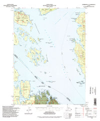
1994 Map of Petersburg A-3
USGS Topo · Published 1998About this map
Tongass National Forest encompasses this complex maritime landscape within the Alexander Archipelago, where the convergence of Stikine Strait and Clarence Strait defines the regional navigation. The map documents a working wilderness in the mid-1990s, highlighting the industrial footprint of the timber and maritime trades through features like the Log Transfer Facility near Shrubby Island and the Cannery Ruins located near Lake Bay. These sites, alongside an Oyster Farm in the Blashke Islands, underscore the reliance on coastal resources.
Find a feature on this map
62 named features on this map. Tap any name to fly to it.
Don’t see what you’re looking for? This feature index may not catch every label — zoom into the map to look around manually.
Map Details
Editions of this 1994 Petersburg A-3 Map
This is the sole edition of this map. No revisions or reprints were ever made.
Other maps of this area

1948 · Petersburg A-2
USGS Topo · 1:63,360

1948 · Petersburg B-2
USGS Topo · 1:63,360

1948 · Petersburg B-3
USGS Topo · 1:63,360

1949 · Craig D-3
USGS Topo · 1:63,360

1949 · Craig D-2
USGS Topo · 1:63,360

1949 · Petersburg A-3
USGS Topo · 1:63,360

1949 · Craig D-4
USGS Topo · 1:63,360

1949 · Petersburg A-4
USGS Topo · 1:63,360

1949 · Petersburg B-4
USGS Topo · 1:63,360

1950 · Craig D-3
USGS Topo · 1:63,360