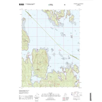
2017 Map of Petersburg A-3 SW
USGS Topo · Published 2017About this map
Coffman Cove sits at the edge of this maritime landscape within the Tongass National Forest, serving as a primary point of human activity on Prince of Wales Island. This 2017 survey details a complex archipelago where the Gulf of Alaska meets the Alexander Archipelago, revealing a coastline defined by intricate waterways and numerous islands. Notable terrain features like Stevenson Island and Thorne Island dominate the western and central sections, while the navigational challenges of Whale Passage and Kashevarof Passage are clearly visible. The map also delineates the administrative boundary between Wrangell Borough and the Prince of Wales-Hyder Census Area, which cuts diagonally across the open water. Smaller landmarks such as Beck Island, Gull Rock, and Keg Point provide essential orientation points for those studying the tidal geography of the Lake Bay region.
Find a feature on this map
29 named features on this map. Tap any name to fly to it.
Don’t see what you’re looking for? This feature index may not catch every label — zoom into the map to look around manually.
Map Details
Editions of this 2017 Petersburg A-3 SW Map
This is the sole edition of this map. No revisions or reprints were ever made.
Other maps of this area

1949 · Craig D-3
USGS Topo · 1:63,360

1949 · Petersburg A-3
USGS Topo · 1:63,360

1949 · Craig D-4
USGS Topo · 1:63,360

1949 · Petersburg A-4
USGS Topo · 1:63,360

1950 · Craig D-3
USGS Topo · 1:63,360

1951 · Craig D-4
USGS Topo · 1:63,360

1952 · Petersburg
USGS Topo · 1:250,000

1953 · Petersburg A-4
USGS Topo · 1:63,360

1953 · Petersburg A-3
USGS Topo · 1:63,360

1957 · Craig
USGS Topo · 1:250,000