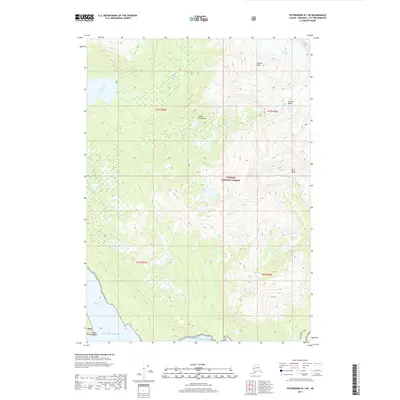
2017 Map of Petersburg B-1 NE
USGS Topo · Published 2017About this map
Virginia Lake and the drainage of Porterfield Cr characterize this coastal mountain landscape within the Tongass National Forest. The terrain is defined by dramatic elevation changes from the Gulf of Alaska shoreline at Madan Bay to the high alpine environments of the Coast Mountains. This survey documents the glaciated topography of the early 21st century, showing the position of Nelson Glacier and the distinct alpine depressions of Glacier Basin and Berg Basin. Human presence is primarily indicated by the Aaron Creek Trail in the southeast, while the rest of the quadrangle remains largely untouched by development. Significant landmarks like Marsha Peak and Point Madan provide reference points for navigating this complex system of ridges and glacial valleys.
Find a feature on this map
18 named features on this map. Tap any name to fly to it.
Don’t see what you’re looking for? This feature index may not catch every label — zoom into the map to look around manually.
Map Details
Editions of this 2017 Petersburg B-1 NE Map
This is the sole edition of this map. No revisions or reprints were ever made.
Other maps of this area

1948 · Petersburg C-1
USGS Topo · 1:63,360

1948 · Petersburg B-1
USGS Topo · 1:63,360

1951 · Bradfield Canal
USGS Topo · 1:250,000

1952 · Petersburg
USGS Topo · 1:250,000

1953 · Petersburg C-1
USGS Topo · 1:63,360

1954 · Bradfield Canal
USGS Topo · 1:250,000

1955 · Bradfield canal C-6
USGS Topo · 1:63,360

1955 · Bradfield canal B-6
USGS Topo · 1:63,360

1955 · Petersburg B-1
USGS Topo · 1:63,360

1955 · Bradfield Canal
USGS Topo · 1:250,000