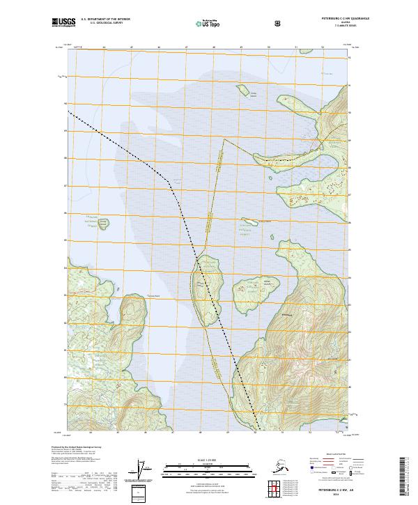
2024 Map of Petersburg C-2 NW
USGS Topo · Published 2024About this map
Frederick Sound dominates the waterscape of this 2024 survey, serving as a primary maritime corridor through the Alexander Archipelago near Wrangell. This coastal environment is defined by the protected lands of the Stikine-Leconte Wilderness and the Tongass National Forest, which encompass a series of named islands and coastal points. Geodetic markers such as Ideal Cove Tri and Mallard Slough Tri indicate the surveying history of this coastline, while features like Cosmos Point and Ideal Cove suggest the intricate shoreline that has long supported local navigation. The land is largely defined by its administrative boundaries, specifically the line between the Petersburg Borough and Wrangell Borough, which cuts through the sound and across several islands, including Pocket Island. This map illustrates the contemporary state of these federally protected wilderness areas and their relation to the surrounding coastal waters.
Find a feature on this map
20 named features on this map. Tap any name to fly to it.
Don’t see what you’re looking for? This feature index may not catch every label — zoom into the map to look around manually.
Map Details
Editions of this 2024 Petersburg C-2 NW Map
This is the sole edition of this map. No revisions or reprints were ever made.
Other maps of this area

1948 · Petersburg C-2
USGS Topo · 1:63,360

1948 · Petersburg C-3
USGS Topo · 1:63,360

1951 · Petersburg C-2
USGS Topo · 1:63,360

1952 · Petersburg
USGS Topo · 1:250,000

1953 · Petersburg C-3
USGS Topo · 1:63,360

1960 · Petersburg
USGS Topo · 1:250,000

1961 · Petersburg D-3
USGS Topo · 1:63,360

1961 · Petersburg D-2
USGS Topo · 1:63,360
1992 · Petersburg C-3 NE
USGS Topo · 1:25,000
1992 · Petersburg C-3 SE
USGS Topo · 1:25,000