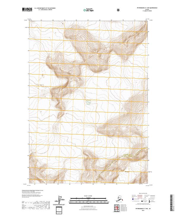
2024 Map of Petersburg D-1 NW
USGS Topo · Published 2024About this map
Tongass National Forest dominates this topographic landscape, where the high-altitude terrain of southeast Alaska is mapped with modern precision. The map illustrates a section of the Stikine-Leconte Wilderness, showing the complex contour lines of the coastal mountains. A significant political boundary bisects the area, marking the transition between Petersburg Borough and Wrangell Borough. Near the southern edge of the sheet, the northern reaches of Wrangell appear, providing a vital geographic link between the wilderness interior and the coastal community. The layout reveals how the dramatic elevation changes and land management boundaries define the region's character, highlighting the interplay between protected federal lands and local borough jurisdictions.
Find a feature on this map
9 named features on this map. Tap any name to fly to it.
Don’t see what you’re looking for? This feature index may not catch every label — zoom into the map to look around manually.
Map Details
Editions of this 2024 Petersburg D-1 NW Map
This is the sole edition of this map. No revisions or reprints were ever made.
Other maps of this area

1952 · Petersburg
USGS Topo · 1:250,000

1952 · Sumdum
USGS Topo · 1:250,000

1960 · Petersburg
USGS Topo · 1:250,000

1960 · Sumdum A-1
USGS Topo · 1:63,360

1961 · Sumdum A-2
USGS Topo · 1:63,360

1961 · Petersburg D-1
USGS Topo · 1:63,360

1961 · Petersburg D-2
USGS Topo · 1:63,360

1961 · Sumdum
USGS Topo · 1:250,000

1994 · Petersburg D-2
USGS Topo · 1:63,360
2000 · Petersburg D-1
USGS Topo · 1:63,360