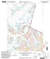
2000 Map of Petersburg D-1
USGS Topo · Published 2003About this map
Tongass National Forest and the Sitkine - Le Conte Wilderness define this high-altitude landscape along the international border. This revision, based on imagery from the turn of the millennium, documents a massive glacial system dominated by the Le Conte Glacier and Shakes Glacier. The topography is characterized by dramatic elevation changes, from the depths of Shakes Lake to prominent summits like Mount Pratt and Castle Mountain. The map serves as a critical record of the United States Canada boundary line, tracing its path across high peaks such as Boundary Peak 69 7329. Other significant ice masses, including the Summit Glacier and Popof Glacier, are mapped in detail, showing the intricate relationship between the ice fields and the surrounding peaks of the Coast Mountains.
Find a feature on this map
15 named features on this map. Tap any name to fly to it.
Don’t see what you’re looking for? This feature index may not catch every label — zoom into the map to look around manually.
Map Details
Editions of this 2000 Petersburg D-1 Map
This is the sole edition of this map. No revisions or reprints were ever made.
Other maps of this area

1948 · Petersburg C-1
USGS Topo · 1:63,360

1948 · Petersburg C-2
USGS Topo · 1:63,360

1951 · Bradfield Canal
USGS Topo · 1:250,000

1951 · Petersburg C-2
USGS Topo · 1:63,360

1952 · Petersburg
USGS Topo · 1:250,000

1952 · Sumdum
USGS Topo · 1:250,000

1953 · Petersburg C-1
USGS Topo · 1:63,360

1954 · Bradfield Canal
USGS Topo · 1:250,000

1955 · Bradfield canal D-6
USGS Topo · 1:63,360

1955 · Bradfield canal C-6
USGS Topo · 1:63,360