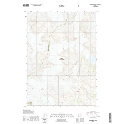
2017 Map of Petersburg D-1 SW
USGS Topo · Published 2017About this map
LeConte Glacier and the surrounding ice-carved terrain dominate this 2017 survey of the Southeast Alaskan wilderness. Situated within the Tongass National Forest, the landscape is defined by the high-elevation movement of the Shakes Glacier and the Popof Glacier, which flow through steep coastal mountains. The boundary between the Petersburg Borough and Wrangell Borough cuts across the icy slopes, marking a remote administrative line in a region where glacial activity remains the primary architect of the geography. Near the southern edge, the recession and melt of these ice fields feed into Shakes Lake, illustrating the ongoing transition of the Alaskan shoreline. This map offers a technical perspective on the sheer verticality of the coastal range, documenting the relationship between these significant ice masses and the rugged interior of the Alexander Archipelago.
Find a feature on this map
10 named features on this map. Tap any name to fly to it.
Don’t see what you’re looking for? This feature index may not catch every label — zoom into the map to look around manually.
Map Details
Editions of this 2017 Petersburg D-1 SW Map
This is the sole edition of this map. No revisions or reprints were ever made.
Other maps of this area

1948 · Petersburg C-1
USGS Topo · 1:63,360

1948 · Petersburg C-2
USGS Topo · 1:63,360

1951 · Petersburg C-2
USGS Topo · 1:63,360

1952 · Petersburg
USGS Topo · 1:250,000

1953 · Petersburg C-1
USGS Topo · 1:63,360

1960 · Petersburg
USGS Topo · 1:250,000

1961 · Petersburg D-1
USGS Topo · 1:63,360

1961 · Petersburg D-2
USGS Topo · 1:63,360

1994 · Petersburg D-2
USGS Topo · 1:63,360
1995 · Petersburg C-1
USGS Topo · 1:63,360