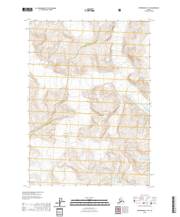
2024 Map of Petersburg D-1 SW
USGS Topo · Published 2024About this map
Stikine-Leconte Wilderness and the surrounding reaches of the Tongass National Forest dominate this modern survey of the Alaskan coast. The map illustrates a high-altitude landscape defined by dramatic elevation changes, where the border between Petersburg Borough and Wrangell Borough winds through the northern portion of the sheet. Unlike more developed regions, this area remains a roadless expanse of protected federal land. Researchers can trace the complex jurisdictional boundaries within the Wrangell vicinity, seeing how the borough lines interact with the designated wilderness boundaries. The cartography focuses on the intricate drainage patterns and steep contours that characterize this portion of Southeast Alaska, providing a clear record of the territory just south of the Stikine River mouth.
Find a feature on this map
8 named features on this map. Tap any name to fly to it.
Don’t see what you’re looking for? This feature index may not catch every label — zoom into the map to look around manually.
Map Details
Editions of this 2024 Petersburg D-1 SW Map
This is the sole edition of this map. No revisions or reprints were ever made.
Other maps of this area

1948 · Petersburg C-1
USGS Topo · 1:63,360

1948 · Petersburg C-2
USGS Topo · 1:63,360

1951 · Petersburg C-2
USGS Topo · 1:63,360

1952 · Petersburg
USGS Topo · 1:250,000

1953 · Petersburg C-1
USGS Topo · 1:63,360

1960 · Petersburg
USGS Topo · 1:250,000

1961 · Petersburg D-1
USGS Topo · 1:63,360

1961 · Petersburg D-2
USGS Topo · 1:63,360

1994 · Petersburg D-2
USGS Topo · 1:63,360
1995 · Petersburg C-1
USGS Topo · 1:63,360