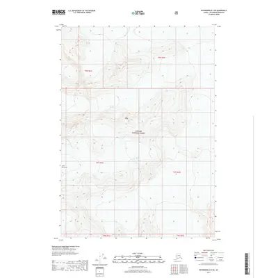
2017 Map of Petersburg D-2 NE
USGS Topo · Published 2017About this map
Patterson Glacier and LeConte Glacier dominate the high-altitude topography of this southeastern Alaska corridor within the Tongass National Forest. The map documents the immense ice fields and glacial movements as they appeared in 2017, carving through the Coast Mountains. This sub-region of the Petersburg Borough is defined by its dramatic elevation changes, reaching toward the prominent summits of Twin Peaks. The cartography relies on 2012 SPOT imagery and the National Elevation Dataset to delineate the complex contour patterns of the glacial valleys and ridge lines. Absent of roads or permanent settlements, the area is shown in its primitive state, governed by the natural forces of the Pacific Northwest's ice and stone.
Find a feature on this map
11 named features on this map. Tap any name to fly to it.
Don’t see what you’re looking for? This feature index may not catch every label — zoom into the map to look around manually.
Map Details
Editions of this 2017 Petersburg D-2 NE Map
This is the sole edition of this map. No revisions or reprints were ever made.
Other maps of this area

1952 · Petersburg
USGS Topo · 1:250,000

1952 · Sumdum
USGS Topo · 1:250,000

1960 · Petersburg
USGS Topo · 1:250,000

1960 · Sumdum A-1
USGS Topo · 1:63,360

1961 · Sumdum A-2
USGS Topo · 1:63,360

1961 · Petersburg D-1
USGS Topo · 1:63,360

1961 · Petersburg D-2
USGS Topo · 1:63,360

1961 · Sumdum
USGS Topo · 1:250,000

1994 · Petersburg D-2
USGS Topo · 1:63,360
2000 · Petersburg D-1
USGS Topo · 1:63,360