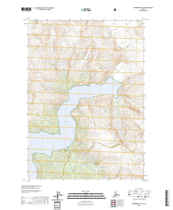
2024 Map of Petersburg D-2 SE
USGS Topo · Published 2024About this map
Le Conte Bay dominates the center of this coastal Alaskan landscape, where the waters of the inside passage meet the steep rising terrain of the mainland. The area is defined by massive protected tracts, including the Stikine-Leconte Wilderness and the Tongass National Forest, illustrating the state's commitment to preserving its maritime and alpine ecosystems. Significant landmarks such as Simpson Peak provide high-elevation points of reference for navigators and surveyors, while Thunder Point and Timber Point mark the winding shoreline of the bay. The map also delineates the administrative boundary between Petersburg Borough and Wrangell Borough, which cuts across the southern portion of the sheet near the settlement of Wrangell. This modern survey provides a clear view of the glacial-carved topography and current jurisdictional lines in a region where the forest meets the sea.
Find a feature on this map
8 named features on this map. Tap any name to fly to it.
Don’t see what you’re looking for? This feature index may not catch every label — zoom into the map to look around manually.
Map Details
Editions of this 2024 Petersburg D-2 SE Map
This is the sole edition of this map. No revisions or reprints were ever made.
Other maps of this area

1948 · Petersburg C-1
USGS Topo · 1:63,360

1948 · Petersburg C-2
USGS Topo · 1:63,360

1951 · Petersburg C-2
USGS Topo · 1:63,360

1952 · Petersburg
USGS Topo · 1:250,000

1953 · Petersburg C-1
USGS Topo · 1:63,360

1960 · Petersburg
USGS Topo · 1:250,000

1961 · Petersburg D-1
USGS Topo · 1:63,360

1961 · Petersburg D-2
USGS Topo · 1:63,360

1994 · Petersburg D-2
USGS Topo · 1:63,360
1995 · Petersburg C-1
USGS Topo · 1:63,360