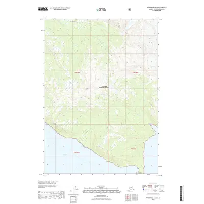
2017 Map of Petersburg D-2 SW
USGS Topo · Published 2017About this map
Thunder Mtn and the striking Horn Cliffs define the steep coastal topography of this portion of the Tongass National Forest. Located within the Petersburg Borough of Alaska, the map details a landscape where glacier-fed waters meet the Pacific, characterized by the Frederick Sound coastline and the southern reach of the Muddy River. The presence of Indian Point at the southeastern edge marks a significant landform at the water's edge, while smaller drainages like Moonshine Cr and Bussy Cr carve through the interior highlands. This survey documents the state of these wilderness boundaries and coastal features in the early 21st century, illustrating the complex intersection of high-relief mountain peaks and intricate tidal shorelines in Southeast Alaska.
Find a feature on this map
13 named features on this map. Tap any name to fly to it.
Don’t see what you’re looking for? This feature index may not catch every label — zoom into the map to look around manually.
Map Details
Editions of this 2017 Petersburg D-2 SW Map
This is the sole edition of this map. No revisions or reprints were ever made.
Other maps of this area

1948 · Petersburg C-2
USGS Topo · 1:63,360

1948 · Petersburg C-3
USGS Topo · 1:63,360

1951 · Petersburg C-2
USGS Topo · 1:63,360

1952 · Petersburg
USGS Topo · 1:250,000

1953 · Petersburg C-3
USGS Topo · 1:63,360

1960 · Petersburg
USGS Topo · 1:250,000

1961 · Petersburg D-3
USGS Topo · 1:63,360

1961 · Petersburg D-2
USGS Topo · 1:63,360
1992 · Petersburg C-3 NE
USGS Topo · 1:25,000

1994 · Petersburg D-2
USGS Topo · 1:63,360