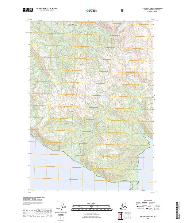
2024 Map of Petersburg D-2 SW
USGS Topo · Published 2024About this map
Frederick Sound defines the southern and western margins of this coastal Alaska landscape, where the tides meet a dramatic vertical rise. The interior is dominated by the steep peaks and glacial drainages of the Tongass National Forest, including the protected Stikine-Leconte Wilderness. High-elevation landmarks like Thunder Mtn and the striking Horn Cliffs overlook the intricate drainage networks of Moonshine Creek and Bussy Creek. Settlement is virtually non-existent here, with human presence marked primarily by the Muddy River Trl following the course of the Muddy River through the northern valley. This modern survey reflects the enduring wild character of the Petersburg Borough, where maritime channels and mountainous terrain remain the primary geographic features.
Find a feature on this map
13 named features on this map. Tap any name to fly to it.
Don’t see what you’re looking for? This feature index may not catch every label — zoom into the map to look around manually.
Map Details
Editions of this 2024 Petersburg D-2 SW Map
This is the sole edition of this map. No revisions or reprints were ever made.
Other maps of this area

1948 · Petersburg C-2
USGS Topo · 1:63,360

1948 · Petersburg C-3
USGS Topo · 1:63,360

1951 · Petersburg C-2
USGS Topo · 1:63,360

1952 · Petersburg
USGS Topo · 1:250,000

1953 · Petersburg C-3
USGS Topo · 1:63,360

1960 · Petersburg
USGS Topo · 1:250,000

1961 · Petersburg D-3
USGS Topo · 1:63,360

1961 · Petersburg D-2
USGS Topo · 1:63,360
1992 · Petersburg C-3 NE
USGS Topo · 1:25,000

1994 · Petersburg D-2
USGS Topo · 1:63,360