
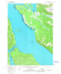
1961 Map of Petersburg D-3
USGS Topo · Published 1966About this map
Petersburg occupies a strategic position at the northern entrance of the Wrangell Narrows on Mitkof Island, serving as a vital hub for maritime and aviation traffic in the early 1960s. The map illustrates the town’s development with infrastructure such as the Seaplane Airport, a Water Tank, and the Petersburg Highway leading south toward Scow Bay. Across the narrows, the Lindenberg Peninsula rises toward Petersburg Mountain, with the smaller settlement of West Petersburg and the Doyhof area marking the western shore.
Find a feature on this map
65 named features on this map. Tap any name to fly to it.
Don’t see what you’re looking for? This feature index may not catch every label — zoom into the map to look around manually.
Map Details
Editions of this 1961 Petersburg D-3 Map
3 editions found
Other maps of this area

1948 · Sumdum A-4
USGS Topo · 1:63,360

1948 · Petersburg C-4
USGS Topo · 1:63,360

1948 · Petersburg C-2
USGS Topo · 1:63,360

1948 · Petersburg C-3
USGS Topo · 1:63,360

1951 · Petersburg D-4
USGS Topo · 1:63,360

1951 · Petersburg C-4
USGS Topo · 1:63,360

1951 · Sumdum A-4
USGS Topo · 1:63,360

1951 · Petersburg C-2
USGS Topo · 1:63,360

1952 · Petersburg
USGS Topo · 1:250,000

1952 · Sumdum
USGS Topo · 1:250,000