
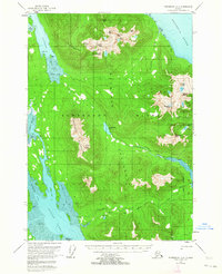
1951 Map of Petersburg D-4
USGS Topo · Published 1958About this map
Lindenberg Peninsula on Kupreanof Island is defined by its deep saltwater inlets and high coastal peaks as they were recorded in the early 1950s. The Petersburg Trail cuts through the interior, following Petersburg Creek from the eastern shore toward the heart of the island near Petersburg Lake. This area of the Tongass National Forest is characterized by its dramatic elevation changes, rising from the tidal flats of Portage Bay and Duncan Canal to the heights of the Missionary Range and Portage Mountains. The map reveals a landscape of isolated outposts, marked simply by several cabins near Salt Chuck and Fivemile Creek, reflecting a time when the wilderness was navigated primarily by water and forest trail. These topographical details illustrate the maritime and terrestrial connections essential for early regional travel and natural resource management.
Find a feature on this map
44 named features on this map. Tap any name to fly to it.
Don’t see what you’re looking for? This feature index may not catch every label — zoom into the map to look around manually.
Map Details
Editions of this 1951 Petersburg D-4 Map
4 editions found
Other maps of this area

1948 · Sumdum A-4
USGS Topo · 1:63,360

1948 · Sumdum A-5
USGS Topo · 1:63,360

1948 · Petersburg C-4
USGS Topo · 1:63,360

1948 · Petersburg C-3
USGS Topo · 1:63,360

1948 · Petersburg C-5
USGS Topo · 1:63,360

1948 · Petersburg D-5
USGS Topo · 1:63,360

1951 · Petersburg C-4
USGS Topo · 1:63,360

1951 · Sumdum A-4
USGS Topo · 1:63,360

1951 · Petersburg C-5
USGS Topo · 1:63,360

1952 · Petersburg
USGS Topo · 1:250,000