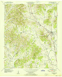
1951 Map of Petersburg
USGS Topo · Published 1951About this map
The Marshall and Lincoln County line bisects this landscape, anchored by the town of Petersburg, where the Nashville Chattanooga and St Louis RR passes through the valley. The map reveals a densely settled rural area connected by numerous family-named landmarks and essential community institutions. Education and faith are central to this mid-century topography, represented by the Morgan Sch, Medium Sch, and several houses of worship including Catalpa Grove Church and Mt Zion Ch.
Find a feature on this map
104 named features on this map. Tap any name to fly to it.
Don’t see what you’re looking for? This feature index may not catch every label — zoom into the map to look around manually.
Map Details
Editions of this 1951 Petersburg Map
3 editions found
Other maps of this area

1936 · Belfast
USGS Topo · 1:24,000

1936 · Cornersville
USGS Topo · 1:24,000

1936 · Lewisburg
USGS Topo · 1:24,000

1936 · Belleville
USGS Topo · 1:24,000

1936 · Boonshill
USGS Topo · 1:24,000

1936 · Petersburg
USGS Topo · 1:24,000

1936 · Bedford
USGS Topo · 1:24,000

1936 · Frankewing
USGS Topo · 1:24,000

1936 · Fayetteville
USGS Topo · 1:24,000

1944 · Shelbyville
USGS Topo · 1:100,000