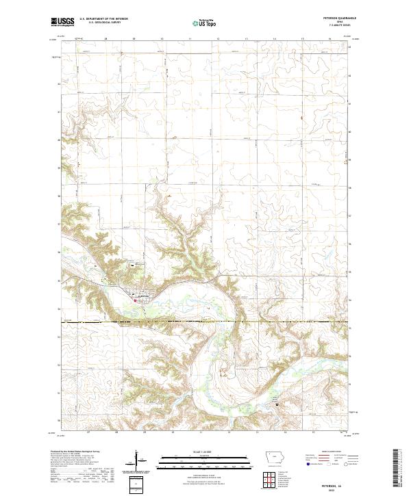
2022 Map of Peterson
USGS Topo · Published 2022About this map
The Little Sioux River carves a deep valley through the northwestern Iowa plains, serving as the geographic anchor for the town of Peterson. This 2022 survey illustrates the town's position at the river's bend, where local streets like E Front St and E 3rd St meet the shoreline. The surrounding landscape is defined by the sharp relief of river-cut drainage patterns, including Cottonwood Gulch and Fox Run, which break the otherwise regular grid of county section lines.
Find a feature on this map
32 named features on this map. Tap any name to fly to it.
Don’t see what you’re looking for? This feature index may not catch every label — zoom into the map to look around manually.
Map Details
Editions of this 2022 Peterson Map
This is the sole edition of this map. No revisions or reprints were ever made.
Other maps of this area

1954 · Fairmont
USGS Topo · 1:250,000

1954 · Fort Dodge
USGS Topo · 1:250,000

1957 · Fort Dodge
USGS Topo · 1:250,000

1958 · Fort Dodge
USGS Topo · 1:250,000

1958 · Fairmont
USGS Topo · 1:250,000

1966 · Greenville
USGS Topo · 1:24,000

1970 · Hartley SW
USGS Topo · 1:24,000

1970 · Royal
USGS Topo · 1:24,000

1971 · Rembrandt
USGS Topo · 1:24,000

1971 · Sioux Rapids
USGS Topo · 1:24,000