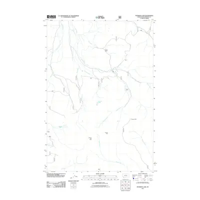
2011 Map of Peterson Lake
USGS Topo · Published 2011About this map
Peterson Lake and the high-elevation drainages of Beaverhead County define this landscape, where early 21st-century topography reveals a network of remote watercourses and seasonal shelters. Historically significant structures such as Alice Cabin and Thayer Cabin provide fixed points for researchers studying backcountry land use and forest management in this part of Montana. The drainage patterns are complex, featuring Andrus Creek, Sage Creek, and Thayer Creek as they descend from the surrounding summits.
Find a feature on this map
22 named features on this map. Tap any name to fly to it.
Don’t see what you’re looking for? This feature index may not catch every label — zoom into the map to look around manually.
Map Details
Editions of this 2011 Peterson Lake Map
This is the sole edition of this map. No revisions or reprints were ever made.
Other maps of this area

1955 · Dillon
USGS Topo · 1:250,000

1957 · Dillon
USGS Topo · 1:250,000

1958 · Dillon
USGS Topo · 1:250,000

1959 · Polaris
USGS Topo · 1:62,500

1959 · Grant
USGS Topo · 1:62,500

1962 · Dillon
USGS Topo · 1:250,000

1965 · Dillon
USGS Topo · 1:250,000
1978 · Jackson
USGS Topo · 1:24,000

1978 · Butch Hill
USGS Topo · 1:24,000
1978 · Coyote Creek
USGS Topo · 1:24,000