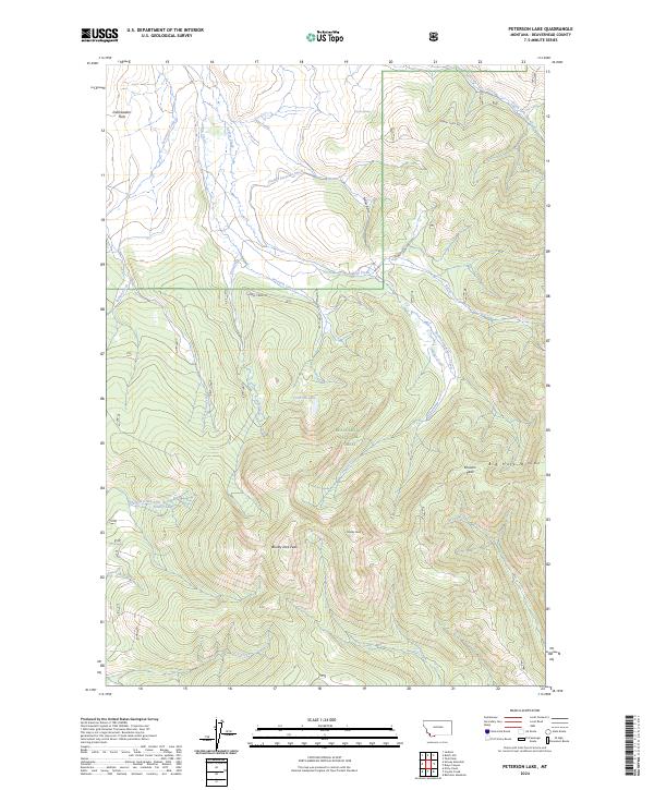
2024 Map of Peterson Lake
USGS Topo · Published 2024About this map
Beaverhead National Forest defines the high-altitude landscape shown here, where the Continental Divide is traced along the Big Hole Divide. The terrain is marked by significant peaks, including Bloody Dick Peak, Painter Peak, and Browns Peak, which tower over a network of alpine drainage systems. Human intervention in this high-country environment is evidenced by the Inabnit Peterson Ditch, which redirects water from Peterson Creek through the rugged slopes near Nellies Gulch.
Find a feature on this map
31 named features on this map. Tap any name to fly to it.
Don’t see what you’re looking for? This feature index may not catch every label — zoom into the map to look around manually.
Map Details
Editions of this 2024 Peterson Lake Map
This is the sole edition of this map. No revisions or reprints were ever made.
Other maps of this area

1955 · Dillon
USGS Topo · 1:250,000

1957 · Dillon
USGS Topo · 1:250,000

1958 · Dillon
USGS Topo · 1:250,000

1959 · Polaris
USGS Topo · 1:62,500

1959 · Grant
USGS Topo · 1:62,500

1962 · Dillon
USGS Topo · 1:250,000

1965 · Dillon
USGS Topo · 1:250,000
1978 · Jackson
USGS Topo · 1:24,000

1978 · Butch Hill
USGS Topo · 1:24,000
1978 · Coyote Creek
USGS Topo · 1:24,000