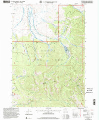
1997 Map of Peterson Lake
USGS Topo · Published 2002About this map
Beaverhead National Forest defines this high-elevation landscape, where the Big Hole basin meets the steep terrain of the continental Divide. The area is characterized by a dense network of mountain drainages, including Governor Creek, Pine Creek, and Peterson Creek, which descend from the surrounding peaks toward the lower basins. Remote outposts like Alices Cabin and Thayer Cabin suggest a history of seasonal forest management or grazing, while the inclusion of a Helispot reflects modern logistical requirements for fire and resource monitoring in the late 20th century.
Find a feature on this map
31 named features on this map. Tap any name to fly to it.
Don’t see what you’re looking for? This feature index may not catch every label — zoom into the map to look around manually.
Map Details
Editions of this 1997 Peterson Lake Map
This is the sole edition of this map. No revisions or reprints were ever made.
Other maps of this area

1955 · Dillon
USGS Topo · 1:250,000

1957 · Dillon
USGS Topo · 1:250,000

1958 · Dillon
USGS Topo · 1:250,000

1959 · Polaris
USGS Topo · 1:62,500

1959 · Grant
USGS Topo · 1:62,500

1962 · Dillon
USGS Topo · 1:250,000

1965 · Dillon
USGS Topo · 1:250,000
1978 · Jackson
USGS Topo · 1:24,000

1978 · Butch Hill
USGS Topo · 1:24,000
1978 · Coyote Creek
USGS Topo · 1:24,000